Cascadia Research has been collaborating with the Northwest Fisheries Science Center of NOAA Fisheries, and Fisheries and Oceans Canada, to examine aspects of the diet of fish-eating “southern resident” killer whales, and to study sub-surface behavior of mammal-eating “transient” killer whales. For the last five years we’ve spent ~4-5 weeks per year based out of the Friday Harbor Labs on San Juan Island undertaking field work. From September 8th through the 20th 2009 we’ll be based in Friday Harbor again undertaking field work. Depending on what groups of whales are in the area, we have a number of goals:
- collecting fecal samples from “southern resident” and “transient” killer whales, to examine diet, as well as for hormone analyses undertaken by Katherine Ayres of the University of Washington. More information on this work is available on our killer whale diet web page
- collecting prey samples from both types of whales to examine diet
- deployment of suction-cup attached time-depth recorders (some with the ability to record sounds) on both types of whales, to examine sub-surface and acoustic behavior. More information on the suction-cup tagging work is available on our killer whale diving behavior web page
- deployment of medium-term satellite tags on “transient” killer whales (attached with darts to the dorsal fin), to examine movements over periods of weeks to months.
- collecting a small number of biopsy samples to examine toxin loads in both fish-eating and mammal-eating killer whales, carrying on analyses originally reported by Krahn et al. in 2007
- opportunistic collection of identification photographs and biopsy samples from minke whales. Photos will be contributed to the Northeast Pacific Minke Whale Project while biopsy samples will be analysed by the Northwest Fisheries Science Center for toxins and stable isotopes.
- collect sighting information on other species of cetaceans in the area.
We’ll post updates and information on this work several times during the field project. The most recent updates are at the bottom of the page.
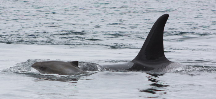 |
A sub-adult harbor porpoise and J-pod whale (J31). Photo by Robin W. Baird. September 9th was our first day on the water, and we worked with whales from J- and K-pods in Haro Strait, collected fish scales and fish bits from three predation events, one mucous sample (likely expelled from the blowhole), and observed a case where a number of whales from both J- and K-pods were interacting with a harbor porpoise. The three whales that spent most of the time with the porpoise were J31, J36, and J39. During the porpoise interaction we did obtain fish (salmon) scale samples from several nearby whales. |
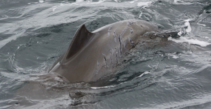 |
Harbor porpoise with tooth rakes from J-pod killer whales. Photo by Robin W. Baird. |
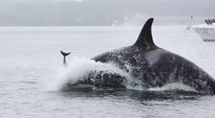 |
J-pod killer whale (J-31) throwing harbor porpoise in air. Photo by Robin W. Baird. The interaction lasted over 30 minutes, and at the end the porpoise died, likely from drowning. After the porpoise died the whales continued ‘playing’ with the carcass for a while before leaving the porpoise floating at the surface. After the whales left the area we collected the porpoise and delivered it to the San Juan Islands Marine Mammal Stranding Network, for a necropsy to be undertaken September 10th. |
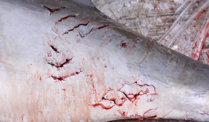 |
Harbor porpoise with tooth rakes from attack by J-pod killer whales. Photo by Robin W. Baird |
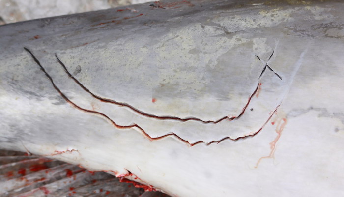 |
Harbor porpoise with tooth rakes from attack by J-pod killer whales. Photo by Robin W. Baird |
September 11, 2009 update
On September 10th and 11th we had two productive days of sample collections – on the 10th we collected seven fecal samples and four mucous samples (likely all of respiratory origin), and on the 11th we collected four predation samples (fish scales) and six fecal samples.
 |
Floating fecal material from a southern resident killer whale. Photo by Robin W. Baird. About a third of the fecal samples we collect float, but most are much less cohesive than this sample. As well as extraction of genetic material from the prey and the whale itself, part of this sample will be used for stress hormone analyses by Katherine Ayres of the University of Washington. |
September 14, 2009 update
On September 15th we had our first encounter with mammal-eating killer whales for this trip. A group of about 10-12 whales were reported off Saturna Island; by the time we arrived on scene there were 8 whales in the group, including T18, T19, T19B, T19C, T60, T60C, T60D, and one other (awaiting confirmation on the last ID). T19B was one of the individuals we deployed a satellite tag on in September 2008 (see our update from that project). We were able to deploy a satellite tag on T60, so are hoping to track the movements of this group over the next few weeks/months (see our satellite tagging page for more information and maps of movements).
| Mammal-eating killer whales, September 14, 2009. Photo by Robin W. Baird. |
September 15, 2009
Today was another productive day collecting samples. We followed most of the southern resident killer whales and collected 11 large fecal samples and 2 mucous samples, bringing our sample total for this trip to 23 fecal samples, 9 mucous samples, and 9 prey samples.
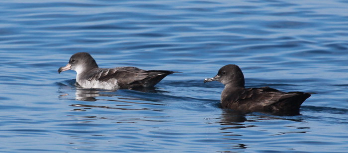 |
Pink-footed (left) and sooty (right) shearwaters, September 17, 2009. Photo by Robin W. Baird. |
September 17, 2009
Although we found no killer whales on the 17th, we encountered several minke whales on Partridge Bank and were able to get identification photographs of at least two individuals.
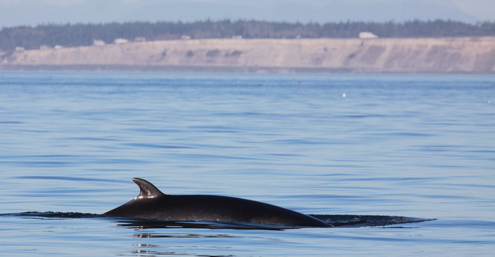 |
Minke whale west of Whidbey Island, September 17, 2009. Photo by Robin W. Baird. |
September 18, 2009
September 18 was to be our last day in the San Juan Islands. While searching for southern resident killer whales to the north of the island we came across two mammal-eating killer whales, T20 and T21, and were able to deploy a satellite tag on T20.
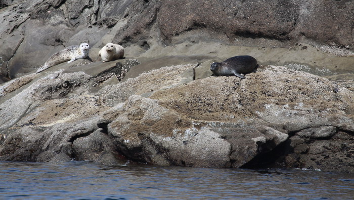 |
Harbor seals on Blunden Islet, September 18, 2009, watching T20 and T21 swim by. Photo by Robin W. Baird. |
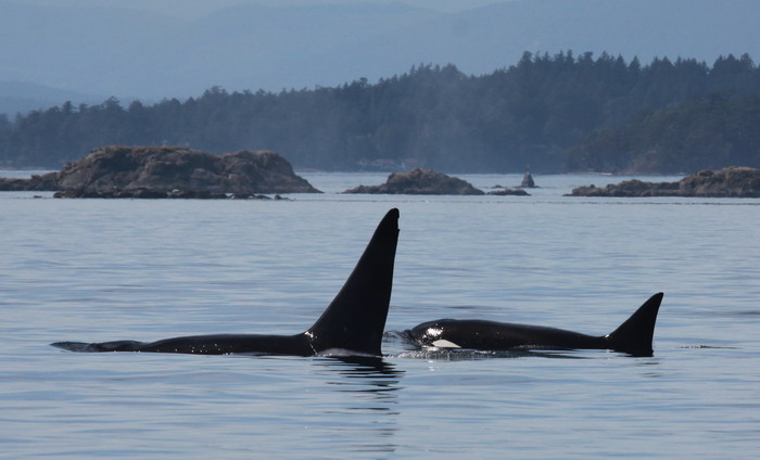 |
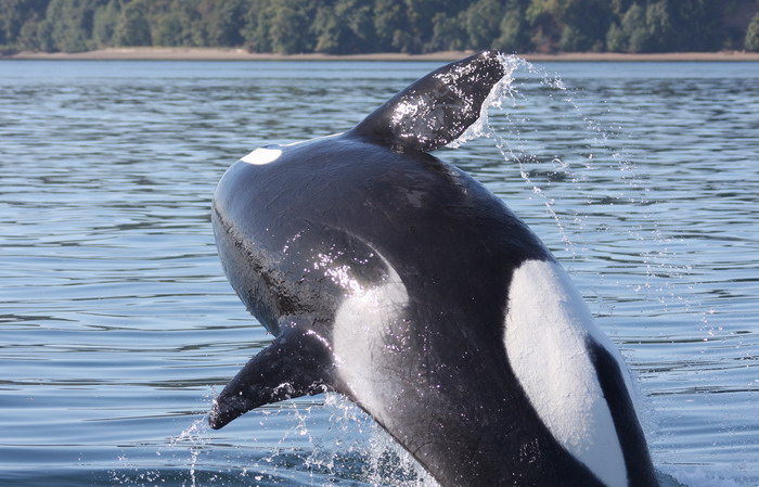
Mammal-eating killer whales T20 (left) and T21 (right), September 18, 2009. Photo by Robin W. Baird. The satellite tag on T20 is visible on the dorsal fin just up from the saddle patch about half way between the leading and trailing edge of the fin. |
September 20, 2009
Although the 18th was our last day working in the San Juan Islands, on September 20th we used two boats to search in the southern part of Puget Sound for a group of mammal-eating killer whales that had been in the Sound for about two weeks. They had been seen early in the morning off Harstene Island but we encountered the group east of Anderson Island. We were able to photo-identify all five individuals present (T137, T137A, T137B, T36A, and T36A1), and deploy a satellite tag on one individual (T36A). We now have satellite tags on three different groups of mammal-eating killer whales and will be able to track their movements over the next few weeks/months.
 |
Mammal-eating killer whales surfacing off Anderson Island, September 20, 2009. Photo by Annie B. Douglas. |
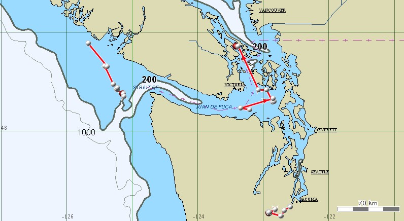 |
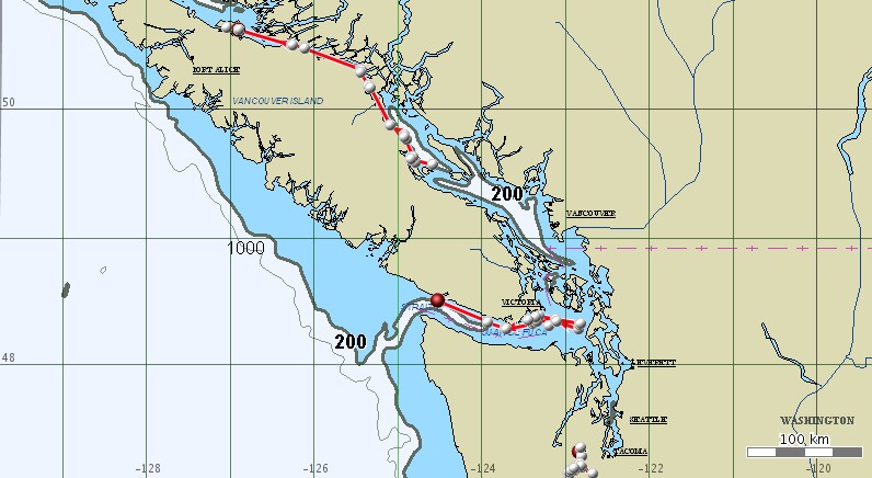
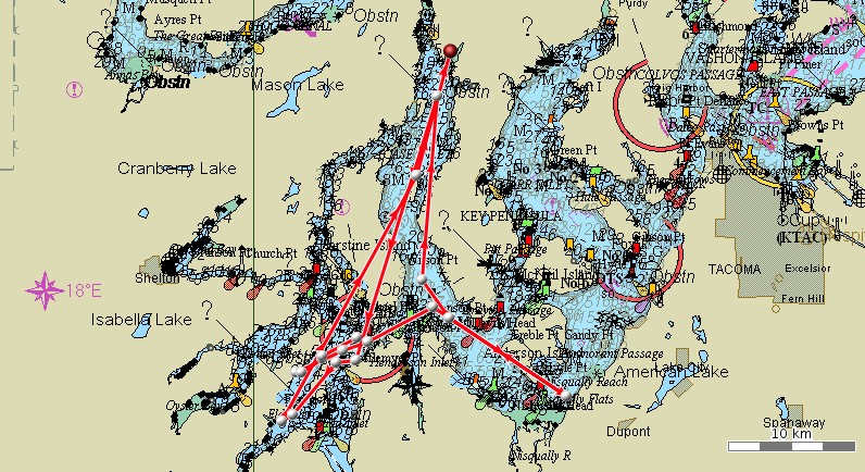
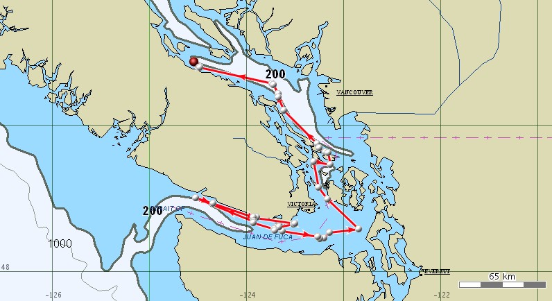
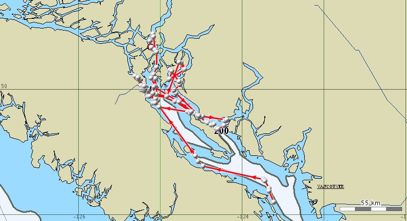
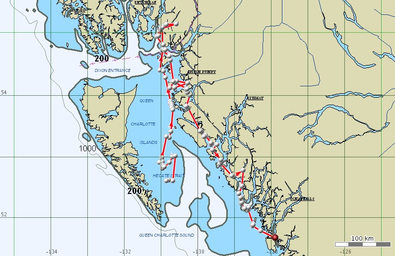
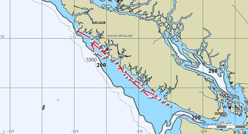
One day of movements of three groups of mammal-eating killer whales, through the evening of September 20, 2009. The locations west of Vancouver Island are of T20, the locations heading north past the San Juan Islands are of T60. |
 |
Mammal-eating killer whales breaching off Anderson Island, September 20, 2009. Photo by Annie B. Douglas. |
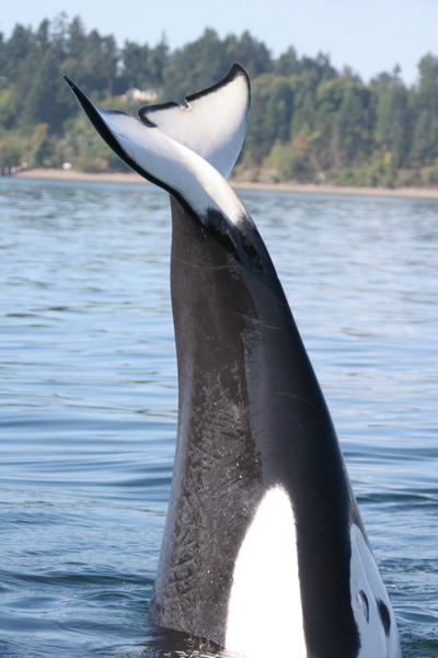 |
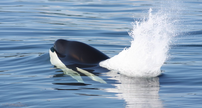
Mammal-eating killer whale with tail out of water, off Anderson Island, September 20, 2009. Photo by Robin W. Baird. |
September 23, 2009 update
 |
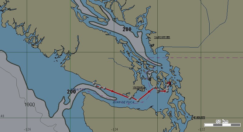
Movements of three groups of mammal-eating killer whale from the evening of September 21st through the morning of September 23rd, 2009. |
The mammal-eating killer whale T60 is the northern-most whale, heading around the north tip of Vancouver Island, while T20 is in Juan de Fuca Strait. A detail of the movements of T36A in southern Puget Sound is below.
 |
Movements of T36A, tagged in southern Puget Sound on September 20th, from the evening of September 21st through the morning of September 23rd, 2009. |
September 26, 2009 update
T36A and company are still in southern Puget Sound. Maps of movements of our other two tagged mammal-eating killer whales for the last three days are below.
 |
Movements of mammal-eating killer whale T20 from the evening of September 22nd through the morning of September 26th, 2009. |
 |
Movements of mammal-eating killer whale T60 from the evening of September 22nd through the morning of September 26th, 2009. |
September 29, 2009 update
On September 28th the whales that had been in southern Puget Sound for an extended period finally left the sound.
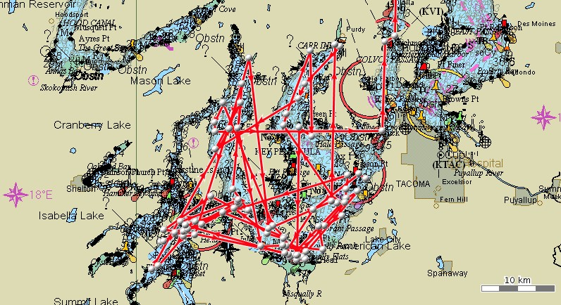 |
Movements of mammal-eating killer whale T36A for the eight days prior to leaving Puget Sound. |
 |
Movements of mammal-eating killer whale T36A for five days through the morning of September 29th. |
October 4, 2009 update
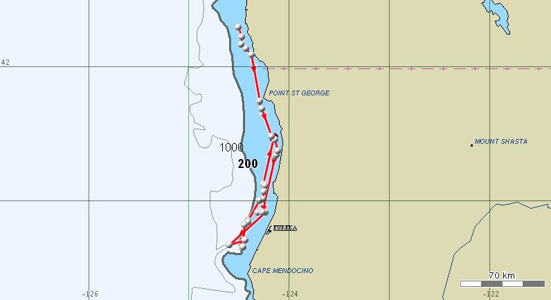
The whales that were in the south Sound are now almost at the Oregon/California border (see map below).
 |
Movements of mammal-eating killer whale T36A for five days through the morning of October 4th. |
T20 has spent the last nine days between Vancouver Island and the mainland.
 |
Movements of mammal-eating killer whale T20 for eightdays through the morning of October 4th. |
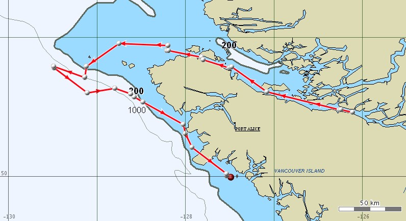
T60 has remained off the west coast of Vancouver Island for the last nine days.
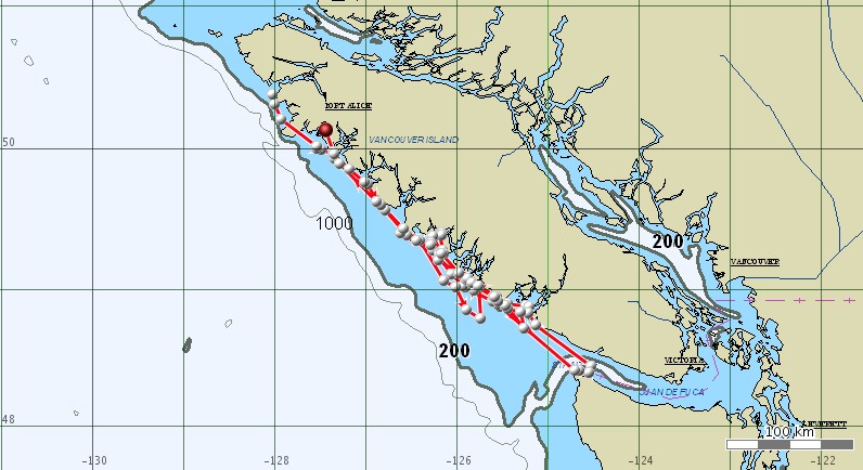 |
Movements of mammal-eating killer whale T60 for eight days through the morning of October 4th. |
October 7 update
T60 and T20 have remained on opposite sides of Vancouver Island since the last update
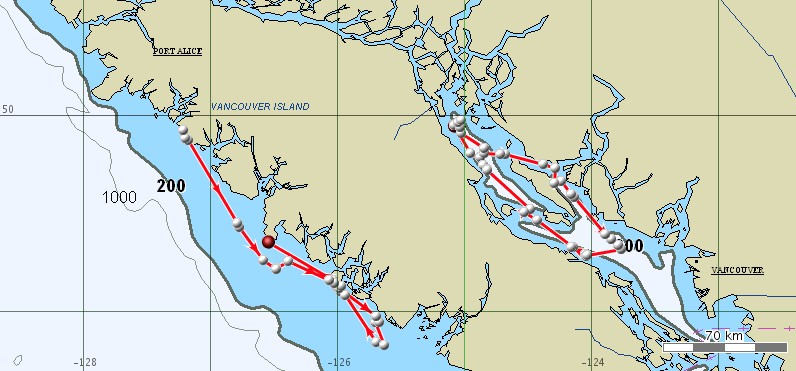 |
Movements of mammal-eating killer whale T60 (to the west) and T20 (to the east) from the evening of October 4th through the morning of October 7th. |
T36A has spent the last two days in northern California.
 |
Movements of mammal-eating killer whale T36A from the evening of October 4th through the morning of October 7th. |
We’ll be out of the country for the next 10 days at the 18th Biennial Conference on the Biology of Marine Mammals (click here for a list of Cascadia’s presentations), so the next update will probably not be until October 19th.
October 19 update
over the last 10 days T36A has spent her time off southern Oregon and northern California, while T20 and T60 have ranged widely through British Columbia.
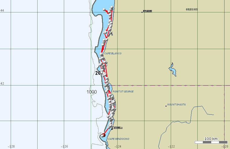 |
Movements of mammal-eating killer whale T36A from the evening of October 8th through the morning of October 19th. |
 |
Movements of mammal-eating killer whale T20 from the evening of October 8th through the evening of October 17th. T20’s tag appears to have stopped working with no locations in the last two days. |
 |
Movements of mammal-eating killer whale T60 from the evening of October 8th through the morning of October 19th. |
October 27 update
We are still getting daily locations from two of the three groups of mammal-eating killer whales satellite tagged in September. Maps of their movements since our last update are below.
 |
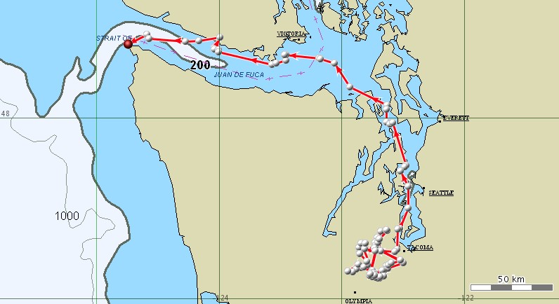
Movements of mammal-eating killer whale T36A from October 19th through the morning of October 27th. After spending time in northern California T36A has moved steadily north back into Washington State, into the Strait of Juan de Fuca. |
 |
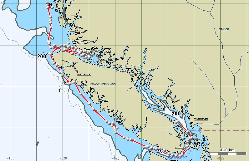
Movements of mammal-eating killer whale T60 from October 19th through the morning of October 27th. T60 moved briefly up into southeast Alaska and is now heading back south along the mainland coast of British Columbia. |
November 15, 2009 update
We are still getting locations from both T60 and T36A, although both tags are now transmitting every second day (to save battery life).
 |
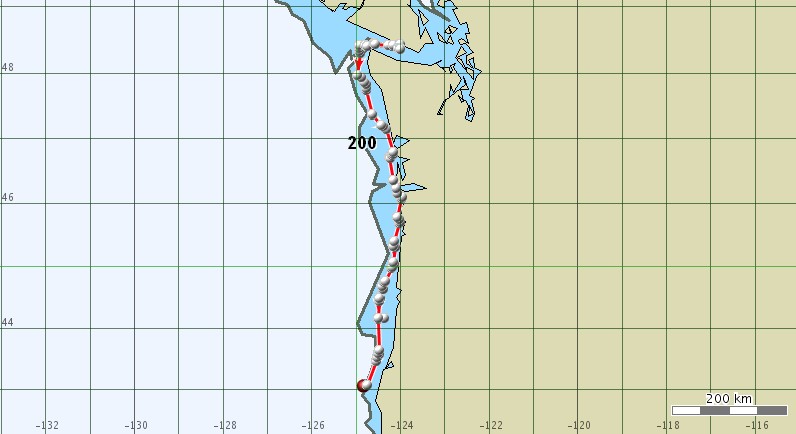
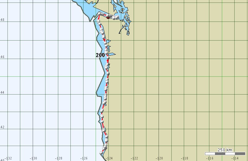
A map of T36A’s movements over a 10-day period through November 9th, 2009. T36A has been moving along the outer coast between southern Washington and northern California for the last couple of weeks. |
 |
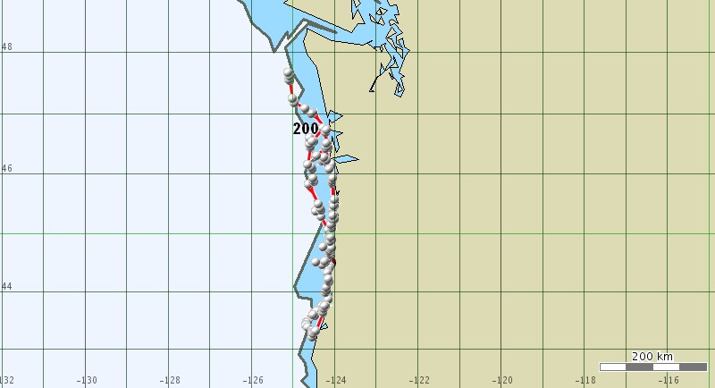
A map of T36A’s movements over a 1-day period through the morning of November 14th, 2009. |
 |
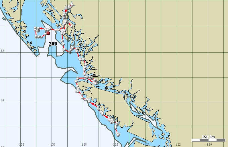
A map of T60’s movements over a 10-day period through November 9th, 2009. |
 |
A map of T60’s movements over a 1-day period through November 14th, 2009. |
All photos taken under NMFS or DFO Scientific Research Permits. Photos on this page are copyrighted and are not to be used without permission.
For more information on this research write to: rwbaird (at) cascadiaresearch.org or brad.hanson (at) noaa.gov.